
Witherslack Woods in south Cumbria are a special place for me because they were the first piece of major survey work that I did when I joined the Nature Conservancy Council as a woodland ecologist in 1979. They are a fantastic mix of acidic and base-rich woodland, of wet and dry communities. My focus in 1979 was on the surviving semi-natural stands, ash-hazel with remnant small-leaved lime on the slopes, patches of oak woodland on the slate, boggy alder-willow in the hollows.
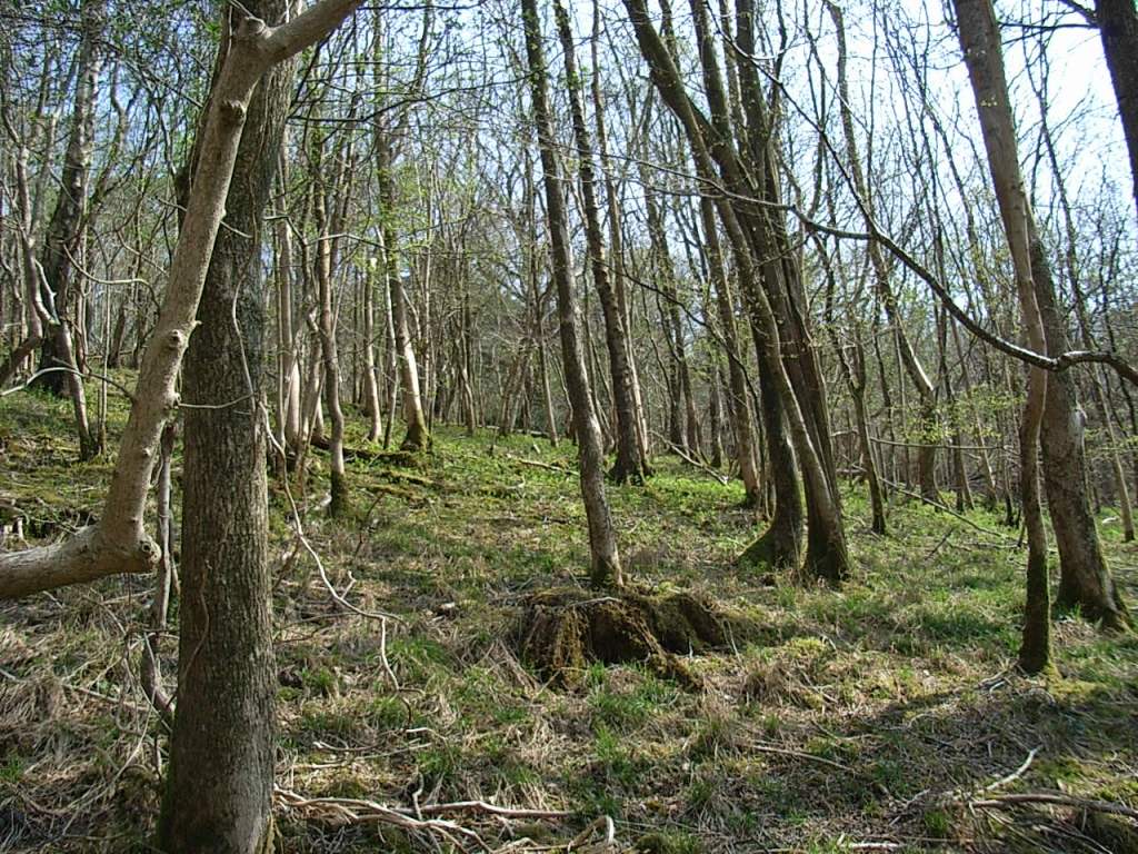


A variety of woodland types within a few hundred metres
A block in the middle of the woodland was ‘written off’ in survey terms because it had been replanted in the 1960s almost entirely with conifers. There seemed no point in bothering to see if anything survived in those stands; the priority was to stop further blocks being felled and converted in the same way, given the forestry policies of the day. Recently I had reason to revisit Witherslack; much of the plantation area had been felled; remnant broadleaved areas (often the wet hollows) had been freed up; other areas showed signs of birch regeneration or were open bluebell glades. Who would have predicted that 43 years ago?


Views from Low Park wood in the early 1980s, early 2000s and in 2022.
The next day I went up on the top of Whitbarrow Scar which overlooks the Witherslack Woods. On Farrar’s Allotment the ‘mohican haircut’ of Corsican pine that had been such a prominent feature in 1979 has gone and the area is a mix of scree, open grassland and scrub.

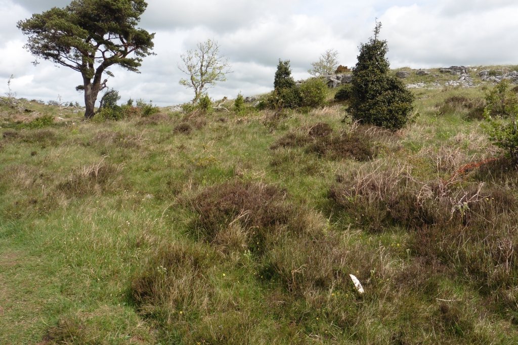
The last of the Corsican pine on Farrar’s Allotment
The western hemlock, stuffed into grykes on the east slopes of Whitbarrow have been removed and parts of the central block now have cattle grazing to help keep them as an open scrubby mosaic.


Western red cedar underplanting (early 1980s); the wandering cattle now on site.
Looking out over the estuary, the plantations on Foulshaw Moss have been removed and bog restored. Meathop Moss which had been a self-sown pine and birch stand with a small open area of bog in the middle is largely cleared apart from the trees round the edge.


Views down on to the restored Foulshaw Moss and Meathop Moss
While seeing these changes in the landscape was heartening, it was tinged with sadness by learning of the recent death of Bob Bunce. Bob was one of the innovative thinkers who contributed to the development of British woodland ecology in the 1970s and beyond. He was the counterweight to the descriptive-historical approach of Oliver Rackham and George Peterken, stressing the importance of standardised, objective survey procedures followed by rigorous statistical analysis. This was reflected in the survey of native pinewoods (Hill et al., 1975) and the methods that underpin much of the ITE/CEH Countryside Survey.
He organised and wrote up the Deciduous Woodland Survey of Scotland, an ambitious attempt to assess the canopy composition of all the larger broadleaved woods across that country. In 1977 I was employed by the Lake District Special Planning Board to do something similar for the National Park and Bob inducted me into the method. This involved a lot of binocular scans of woods on the other side of the valley to try to pick out the proportions of oak, ash and birch, while being alert to the occasional minor species such as alder. I doubt my results were as good as he would have achieved, but the experience helped me get the NCC woodland job a couple of years later.


The proportion of ash is easy to spot in the spring, not so easy later in the year.
In 1971 he used an early form of cluster analysis of the several thousand record cards of woods across Britain amassed by Dick Steele to produce 103 groups from which the central wood in the group was selected for survey, using randomly placed plots. Only limited analysis of the 1971 survey was done at the time; it was used to produce a classification of the plots (vegetation types) but this was not formally published until the 1980s (Bunce, 1982). Copies were available before then, but because it worked on quadrat data it was not easily adapted for vegetation mapping. The Nature Conservancy had split by this stage, with Bob going into ITE; George Peterken’s Stand Type classification became the standard for describing SSSIs in NCC with the National Vegetation Classification being developed in the wings. However, plot recording in the 1980s did follow an approach that allowed Bob’s classification to be used in parallel with other systems.

The standard ‘Bunce and Shaw’ woodland recording plot.
In the 1990s he proposed that the 1971 survey be repeated and we put together a consortium led by English Nature to fund the work. The results (the 2001 re-survey) identified that some of the trends suggested by local studies – the increasing shadiness of woods, impacts of deer, eutrophication and climate change were detectable at a national level (Kirby et al., 2005). A second re-survey of the 103 broadleaved woods and of the pinewoods is currently underway, with the work being led this time by the Woodland Trust. It was a meeting of the advisory group for this resurvey that was the reason for my recent visit to Witherslack Woods.

BUNCE, R. G. H. 1982. A field key for classifying British woodland vegetation, Cambridge, Institute of Terrestrial Ecology.
HILL, M., BUNCE, R. & SHAW, M. 1975. Indicator species analysis, a divisive polythetic method of classification, and its application to a survey of native pinewoods in Scotland. The Journal of Ecology, 63, 597-613.
KIRBY, K. J., SMART, S. M., BLACK, H. J., BUNCE, R. G. H., CORNEY, P. M. & SMITHERS, R. J. 2005. Long-term ecological changes in British woodland (1971-2001). English Nature Research Report 653. Sheffield.
